Cherry Brook
East of this is Collinsville
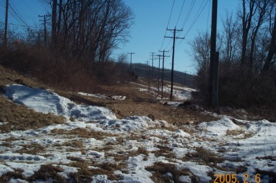
Cherry Brook was a flag stop station for the CNE. The station used to sit about where the stop light is on Route 44 next to the bridge. This area is going through some major construction and upgrades so I'll wait until CDOT is done to take and more pictures of this area.
In the distance you can make out a level line about halfway up the embankment. That level continues around the bank and comes out at the top of the abutment below:
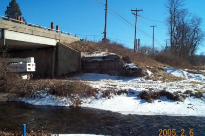
The old abutment to the right of the highway may or may not be a CNE construct.
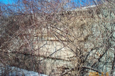
This is the west abutment of an old bridge over Cherry Brook. From here the line continues up the east bank of the Farmington River. The turn out off of Route 44 next to the river upstream of the bridge that is used by the water enthusiasts to pull their kayaks and tubes out is actually the old roadbed. After there it continues under Route 44 until it and the river bear off to the left. Tim Dowd has a good picture of the berm as it turns with the river and pictures of the line through the Satan's Kingdom Gorge here - Tim's Satan's Kingdom
I will pick up again west of the Gorge as I have yet to follow Tim's adventurous lead. The next stop is Pine Meadow